A model built while the epidemic was still moving#
On 27 August, Google Research published something with unusually high stakes for a machine learning paper. The planetary prediction engine, or PPE, is an AI system that takes a question written in ordinary English, goes and finds the data to answer it, builds a predictive model, and writes up the results. No data engineering team required.
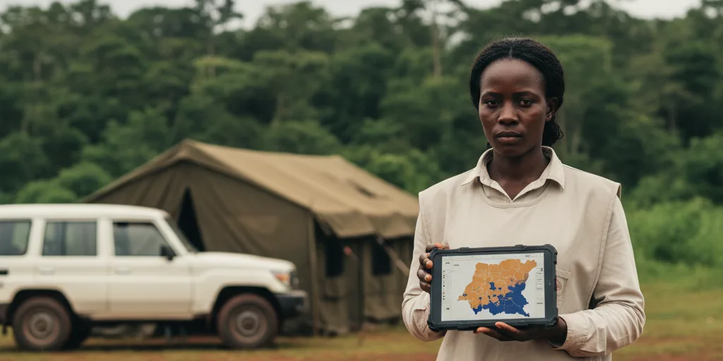
The test case that matters most to anyone working in infectious disease is the third one in the paper. Google ran PPE against the Bundibugyo ebolavirus outbreak in the Democratic Republic of the Congo, asking it to predict which health zones would report their first case next. Across five consecutive weekly forecasts, the system's top ten warnings captured 15 of the 18 zones that were actually invaded.
That outbreak is not a historical exercise. As of 26 August, the DRC has reported 5,794 confirmed cases and 2,786 deaths, a crude case fatality ratio of 48.1%, spread across 60 health zones in six provinces. WHO classes it as the largest Ebola outbreak ever recorded in the country, of any species. It has been a Public Health Emergency of International Concern since 17 May.
So the question is not academic. If a general purpose AI agent can build a decent invasion model in minutes, that changes what a stretched outbreak response can afford to do.
What the engine actually is, in plain terms#
Strip away the branding and PPE is a pipeline with three stages, each supervised by a large language model acting as a coordinator.
The first stage reads your question and works out what kind of prediction problem it is. Forecasting where a virus goes next is a different statistical animal from estimating diabetes prevalence in a US census tract, and the system sorts this out early. It then hunts for input variables, which modellers call covariates, drawing on repositories such as Data Commons and Google Earth Engine. When those come up short, it searches government portals and academic archives live, mid-run.
The second stage fuses that tabular data with something less familiar: embeddings from geospatial foundation models. An embedding is a compact numerical fingerprint of a place. AlphaEarth Foundations compresses a year of satellite observations into 64 numbers per 10 metre pixel, covering optical imagery, radar that sees through cloud, elevation and climate. The Population Dynamics Foundation Model, or PDFM, does something similar for human activity, using a graph neural network trained on aggregated search trends, map features, busyness, weather and air quality. Neither is interpretable in the way a variable called "population density" is. They encode patterns nobody explicitly named.
This stage also runs a Feature Gate that throws out any variable letting the model cheat: no components of the target's own formula, nothing from the same survey, nothing that is a consequence rather than a cause, and nothing dated after the prediction window. Leakage of this kind is the standard way geospatial models look brilliant in a paper and fail in the field, so building the check into the machinery is sensible engineering.
The third stage tries several model families, tunes them, and restarts the search if performance on held-out data degrades.
Why this matters for outbreak response#
The authors make a claim that sounds like throwaway detail but is the whole point: an epidemiological nowcasting workflow can involve more than 700 discrete steps across data selection, cleaning and model tuning. Weeks of skilled work. During an outbreak, weeks are the resource you do not have.
Geographic targeting carries unusual weight in this emergency. Unlike Zaire ebolavirus, Bundibugyo virus has no licensed vaccine and no specific therapeutic, so ring vaccination is not on the table. What remains is surveillance, contact tracing, isolation capacity and early supportive care, all of which must be physically moved to the right places before cases appear there. A watch list that is right more often is worth real money and real lives.
The funding context sharpens this. Health Policy Watch reported in January that Germany was halving its contribution to the WHO Hub for Pandemic and Epidemic Intelligence, with WHO's Chikwe Ihekweazu saying the Epidemic Intelligence from Open Sources system could only run at a minimally viable level in 2026. The European Commission has since committed over €4 million to the Berlin hub, but the direction of travel in global health financing is not generous. Tools that cut the number of specialists needed per model are arriving as specialists are being cut.
Where the numbers get shakier#
The headline gain on the Ebola task is 83.3% recall against roughly 73% for the previous best model, an improvement of 10.3 percentage points. Read the confidence intervals and the picture softens. PPE's 83.3% carries a 95% interval of 60.8% to 94.2%, and a stripped down version using only conventional covariates scored 77.8% (54.8% to 91.0%). Both ranges comfortably contain the 73% baseline. With only 18 invasion events to score against, one zone landing differently shifts the headline by over five points. My reading is that this shows competitive performance, not established superiority. The authors do not overclaim, but the framing invites a stronger conclusion than the interval supports.
The baseline itself deserves a look. It is a real time modelling report posted in July by INRB, Oxford, WHO, Africa CDC and Flowminder, and it states plainly that the work is preliminary and pending publication. A preprint measured against a non peer reviewed forum report is not a settled standard. The two teams also overlap: Dav M. Ebengo of INRB is an author on both documents. This is collaboration rather than a contest, which is arguably the better story.
There is also an asymmetry in inputs. The INRB team used Flowminder mobility estimates derived from anonymised mobile operator data, and found that including them consistently improved performance. PPE worked with road travel times from OpenStreetMap routing instead. Whether a fully automated agent could have discovered and negotiated access to privacy-controlled telecoms data is not tested here, and in operational settings that access is usually the hard part.
The paper is refreshingly direct about its limits. Embeddings are used frozen, without fine tuning. Causal direction filtering is not formally verified. The epidemiological evaluation covers exactly one outbreak, one pathogen, one country, and the authors say validation across diverse pathogens and surveillance systems would be needed to claim generalisation. That caveat should travel with every citation of these results.
One finding cuts against the marketing and is more interesting for it. On the US social vulnerability downscaling task, adding high resolution satellite embeddings on top of the other inputs made things worse, dropping R² from 52.0% to 40.1%. More data, worse model. The team attributes it to high frequency noise and spurious correlation at fine scales. Anyone planning to bolt satellite embeddings onto a health model should take that seriously.
Finally, availability. PPE is described as an experimental research capability. There is no public API, no code release and no independent replication. Nobody outside Google has run it.
What is actually new here#
The obvious comparison is Google Flu Trends, which by 2013 was overestimating influenza-like illness at more than twice the CDC's figures. Lazer and colleagues diagnosed that failure in Science as algorithm drift plus an unwillingness to combine the new signal with conventional surveillance. PPE reads like a response to that critique. It does not replace epidemiological data; it takes case counts as input and adds context. Its best results come from combining embeddings with ordinary statistical covariates, and the ablations show neither modality wins alone.
The other useful comparison is with geospatial foundation models used the old way. A validation study in Malawi applied PDFM and AlphaEarth embeddings to 15 routine health indicators and beat traditional geostatistical interpolation on 13 of them, but a research team still had to frame the problem, fetch the data and fit the models. What PPE adds is not better representations. It removes the human pipeline between a question and a model. Whether that is transformative or merely convenient depends on how much of the hard work in outbreak analytics was ever the data plumbing, rather than knowing which question to ask and whether to trust the answer.
Key takeaways#
- PPE builds geospatial prediction models from natural language queries, collapsing a workflow that can exceed 700 manual steps into a single automated run.
- On the 2026 DRC Ebola outbreak it flagged 15 of 18 newly invaded health zones within its top ten weekly warnings, though the confidence interval spans 60.8% to 94.2% and does not cleanly separate it from the existing model.
- Its consistent advantage comes from fusing foundation model embeddings with conventional covariates, not from either source alone.
- More resolution is not always better: adding fine grained satellite embeddings degraded one downscaling task substantially.
- The work is a preprint, evaluated on one outbreak, with no public access or independent replication. Treat it as a promising result, not a validated tool.
Frequently asked questions#
Is the planetary prediction engine available to use? No. Google describes it as an experimental research capability within Google Earth AI. There is no public API or code release.
Has this work been peer reviewed? Not yet. It is a preprint on arXiv posted on 26 August 2026, released under a CC BY 4.0 licence. The comparison baseline is also unpublished.
What is a geospatial foundation model embedding? A vector of numbers summarising what a location is like, learned from large volumes of satellite or population data rather than hand-picked by a researcher. AlphaEarth produces 64 numbers per 10 metre pixel; PDFM produces 330 or 512 per administrative area.
Does it predict pandemics before they start? No, and this distinction matters. It nowcasts where an ongoing outbreak is likely to spread next, using confirmed case data as an input. It does not detect novel pathogens or anticipate spillover.
Could this replace epidemiologists? Nothing in the paper supports that. It automates data assembly and model fitting. Deciding what to model, judging whether an output is plausible and turning a risk ranking into a deployment plan remain human work.
How does it compare with WHO's existing systems? They do different jobs. EIOS, run by the WHO Hub in Berlin, scans open sources for early signals of unusual events. PPE builds quantitative spatial models once an outbreak is confirmed and case data exists.
Why did adding satellite data sometimes make results worse? On the county to ZIP code social vulnerability task, high resolution land surface features appear to have introduced noise and spurious local correlations that disrupted broader socioeconomic signals. The authors flag adaptive feature selection as future work.
References#
Primary research
- Ma E, Pasumarthi RK, Shafin K, et al. Planetary Prediction Engine: Autonomous Geospatial Prediction via Intelligent Data Selection and Foundation Model Embeddings. arXiv:2608.26088, 26 August 2026. PREPRINT, not peer reviewed. https://arxiv.org/abs/2608.26088
- Pasumarthi R, Shetty S. Planetary prediction engine: Automating global models via Earth AI. Google Research Blog, 27 August 2026. https://research.google/blog/planetary-prediction-engine-automating-global-models-via-earth-ai/
- Agarwal M, Sun M, Kamath C, et al. General Geospatial Inference with a Population Dynamics Foundation Model. arXiv:2411.07207. PREPRINT. https://arxiv.org/pdf/2411.07207
- Brown CF, Kazmierski MR, Pasquarella VJ, et al. AlphaEarth Foundations: An embedding field model for accurate and efficient global mapping from sparse label data. arXiv:2507.22291, 2025. PREPRINT. https://developers.google.com/earth-engine/datasets/catalog/GOOGLE_SATELLITE_EMBEDDING_V1_ANNUAL
- Metz L, Haggard R, Moszczynski M, et al. Application and Validation of Geospatial Foundation Model Data for the Prediction of Health Facility Programmatic Outputs: A Case Study in Malawi. arXiv:2510.25954. PREPRINT. https://arxiv.org/abs/2510.25954
- Ebengo DM, Mills C, Judge C, et al. Real-time spatiotemporal risk modelling of the Bundibugyo Ebola virus outbreak 2026. Epidemiological, 17 July 2026. PRELIMINARY REPORT, not peer reviewed, publication in preparation. https://www.epidemiological.org/t/real-time-spatiotemporal-risk-modelling-of-the-bundibugyo-ebola-virus-outbreak-2026/16
- Lazer D, Kennedy R, King G, Vespignani A. The Parable of Google Flu: Traps in Big Data Analysis. Science 2014;343(6176):1203-1205. https://www.science.org/doi/10.1126/science.1248506
- World Health Organization. Ebola disease caused by Bundibugyo virus: Democratic Republic of the Congo. Disease Outbreak News, 28 August 2026 (DON616). https://www.who.int/emergencies/disease-outbreak-news/item/2026-DON616
- World Health Organization. Ebola disease caused by Bundibugyo virus: Democratic Republic of the Congo. Disease Outbreak News, 21 May 2026 (DON603). https://www.who.int/emergencies/disease-outbreak-news/item/2026-DON603
- World Health Organization. Ebola outbreak: DRC 2026. https://www.who.int/emergencies/situations/ebola-outbreak---drc-2026
- ReliefWeb. DR Congo/Uganda: Ebola Outbreak, May 2026. https://reliefweb.int/disaster/ep-2026-000071-cod
- European Centre for Disease Prevention and Control. Ebola disease outbreak in the Democratic Republic of the Congo and Uganda. https://www.ecdc.europa.eu/en/ebola-outbreak-democratic-republic-congo-and-uganda
- US Centers for Disease Control and Prevention. Ebola Disease Outbreak in the Democratic Republic of the Congo and Uganda. HAN Health Advisory 00530, May 2026. https://www.cdc.gov/han/php/notices/han00530.html
- WHO Hub for Pandemic and Epidemic Intelligence. https://pandemichub.who.int/
- Google DeepMind. AlphaEarth Foundations helps map our planet in unprecedented detail. 30 July 2025. https://deepmind.google/blog/alphaearth-foundations-helps-map-our-planet-in-unprecedented-detail/
- Google Research. Insights into population dynamics: A foundation model for geospatial inference. 14 November 2024. https://research.google/blog/insights-into-population-dynamics-a-foundation-model-for-geospatial-inference/
- Google Earth Engine. https://earthengine.google.com/ and Data Commons. https://datacommons.org/
- Health Policy Watch. Germany To Halve Funding For Pandemic Hub Amid Global Health Pull-back. 9 January 2026. https://healthpolicy-watch.news/germany-cuts-pandemic-surveillance-hub/
- Insight EU Monitoring. EU Commission and WHO strengthen cooperation on pandemic intelligence. 28 July 2026. https://ieu-monitoring.com/editorial/eu-commission-and-who-strengthen-cooperation-on-pandemic-intelligence/1246687
Note on evidence: performance figures come from a preprint that has not completed peer review, and the Ebola comparison baseline is a preliminary report. Sentences beginning "my reading" or "arguably" are the editor's interpretation rather than findings. This article does not offer medical or clinical advice.